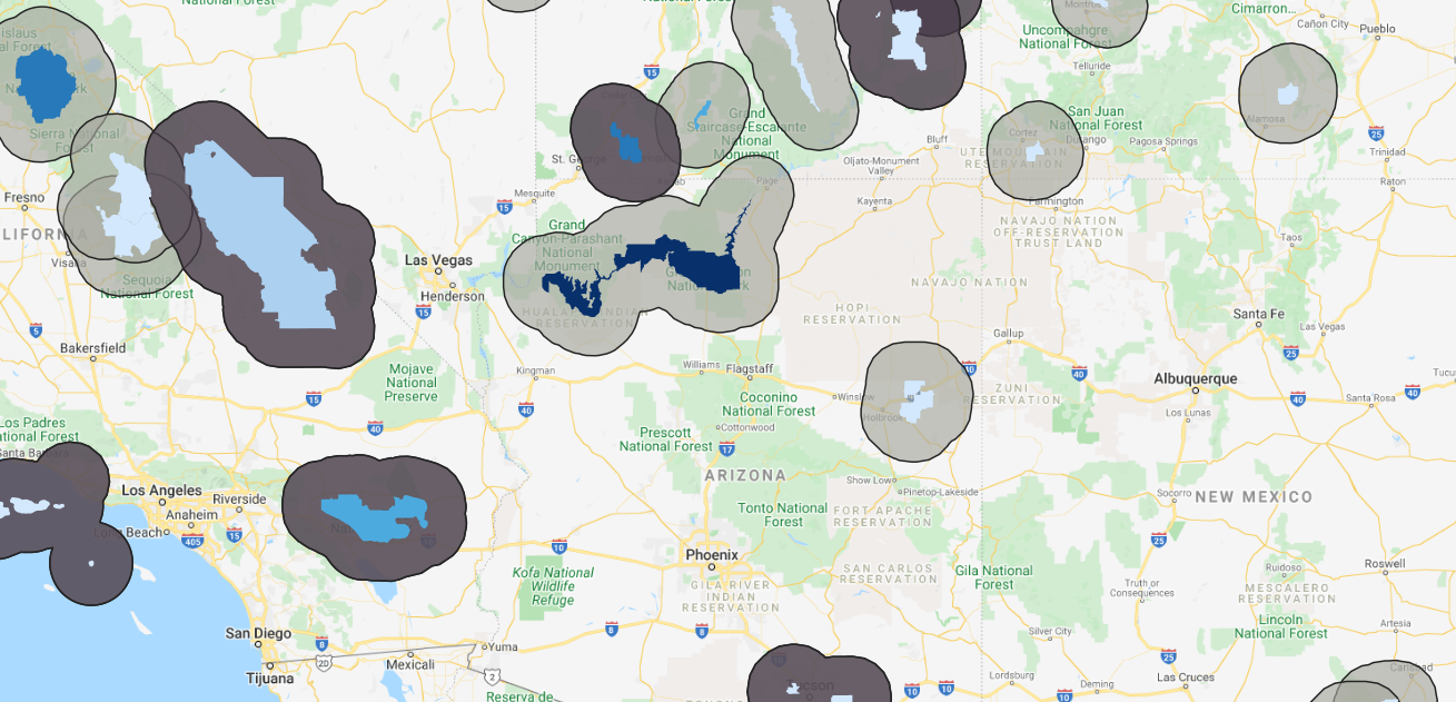
National Park Visitation and Highways in the United States
Legend
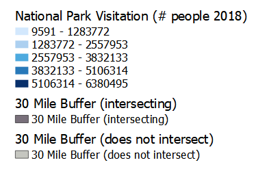
The darker 30 mile buffer is intersecting with highways or major roads and
the lighter are not intersecting with highways or major roads
Project description:
This project is an interactive webmap created in QGIS, using data gathered from the National Park Service and the US Census Bureau. The data highlights 58 national parks in the United States and using a Google Maps basemap, and a major roads map(not shown) from the Census. I used a buffer around each national aprk shapefile of and arbitrary 30 miles, to show which parks are most accessible from the highway. Out of the 58, 21 of these parks are; within 30 miles of the major road, or adjacent to one of these parks. Surprisingly or not surpisingly, the most visited National Park in the United States is the Grand Canyon. Most of the highly visited parks(with some exception) are further off the highway or a major road than the low end parks. The least visited parks are in Alaska, which also makes sense since these may end up being the least accessible (geographically and financially) of all of the parks. Another potential major factor of people visiting national parks is name recognition; Yellowstone, Yosemite, Zion, Grand Canyon, and each of these parks happens to be situated more than 30 miles outside of a highway or major road. This may contribute to people wanting to be further from civilzation when enjoying a park.